By Ruben Lowman
The Buck Creek Watershed, a major drainage basin for the entire county located in Longs, received more than a million dollars in federal funding last week in order to study flooding that has historically been a consistent problem for surrounding residents, including in 2018 after Hurricane Florence.
The study, which will be funded by the recently signed federal infrastructure bill, will come from the Department of Agriculture and could potentially see the watershed become the recipient of further rounds of funding depending on its outcome. The purpose of the “feasibility report” is to examine the key underlying issues of the flooding, and hopefully determine a solution that will prevent or mitigate the damage caused when storms occur in the area.
Changes within the primarily agricultural watershed are a concern regarding recent “flood events,” said Michael Mascari, a spokesman with the USDA’s Natural Resources Conservation Service.
“A watershed plan will provide guidance for reducing flood damages.”
As the Longs community has grown rapidly in recent years, the threat and danger the flooding creates for residents has increased with the population surge. Residents and county officials both hope they can finally come to a solution to the problem.
The watershed is an integral part of the local natural ecosystem and feeds into an extensive array of rivers, lakes and streams that includes the Waccamaw River.
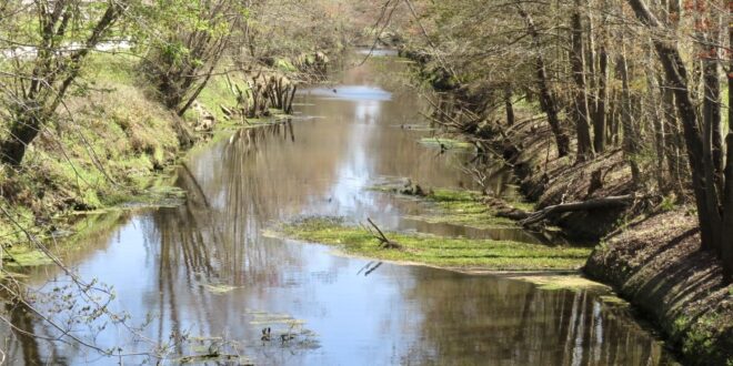
Buck Creek runs alongside Highway 9 in Longs beginning near the state line, flowing over Highway 905 before continuing down and emptying out at the Waccamaw where Chris Anderson Boat Landing is located.
Before it reaches the Waccamaw, it cuts several paths into the local landscape, providing the Donford Branch for Crown Park Golf Club and running just behind Aberdeen Country Club, where it provides the lush marsh setting and beautiful reservoirs of water that mark the course out.
Horry County officials said that they initiated the funding request for the study as part of an initial round of funding that they hope will include working towards a major solution to the problem. As of right now they haven’t been able to extensively identify the reason why the area around the creek floods to such a great extent, in part because they still don’t understand just how water moves through the watershed.
The benefit of that large effort would be a study and mitigation plan that could suggest improvement projects, county officials said, with potential regulations and assist the county in securing further grant funding. Additionally, this initial study will give county officials the opportunity to pursue a future study and watershed mitigation plan that would be larger in scope and encompass a broader area.
Mascara said the watershed was chosen for the funding because it was highlighted as one of the most critical and highest priority projects for improving the nation’s land and water resources.
Watershed projects like Buck Creek usually need around a year and a half for officials to plan, Mascara said, then two years to design the plans they create, concluding with the construction that typically takes between two and five years. He said there will be further funding for more projects throughout the area that will be announced on March 31.
 North Myrtle Beach Times Serving our Community and the Grand Strand for over 50 years


